Waterfalls Of The Western Upper Peninsula
Paul Austin is a creative director and author who freelances for Thumbwind Publications. His real passion and creative outlet is researching historical sites and people with fascinating stories. You can find most of this work on Michigan4You.
Upon studying a Michigan map, it's no secret that most waterfalls reside in the Western Upper Peninsula. Although we know it as the "Copper Country," this is also the land of waterfalls.
Editor Note: This article was taken from the original site of mittenexpedition.com, founded by Michelle Guilbault and Jake Hooker. This restoration of their work is a nod to their efforts, and we want to keep it alive and online.
A Little Background
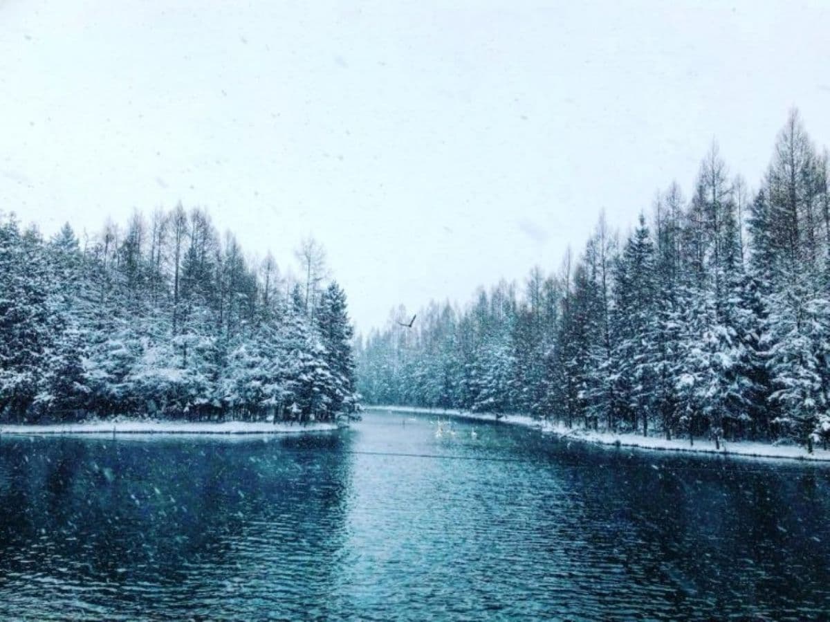
Before a recent Upper Peninsula visit, I had made a point of delegating a day to experience as many waterfalls as possible. The home base was in au train on this vacation, so we were right where we needed to be.
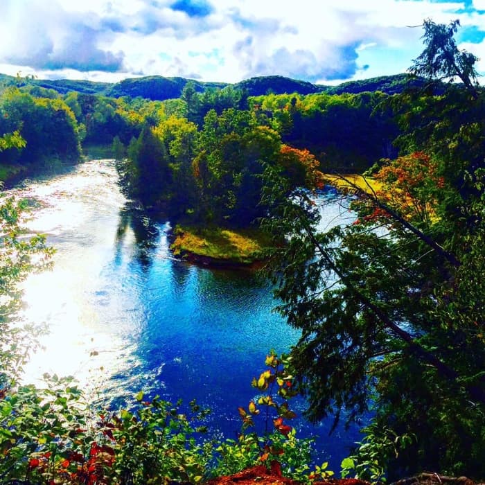
Accompanied by my girlfriend Michelle, our goal was to hit several Upper Peninsula waterfalls on a recent trip to Au Train. We have witnessed the beauty of Tahquameon Falls a few times prior, so discovering some lesser-known falls was a priority. I used the help of some internet-based waterfall databases and Google Maps to set up possible routes we could efficiently take. After researching which falls were relatively easily accessible (minimize ten-mile hikes for time purposes), we developed the game plan. To adequately organize the waterfalls for blogging purposes, I decided to group them by region. This is not a comprehensive list of every waterfall in the U.P. It is rather a summary of our trip and what aspiring travelers could do similarly while visiting these areas.
The regions are:
Pictured Rocks (Eastern U.P.)
Munising/Au Train (Eastern U.P.)
Marquette (western U.P.)
L'Anse/Baraga (Western U.P.)
Keweenaw (Western U.P.)
*note: As our "Expeditions continue into new territories, we will add to the list. For example, Bond Falls is one of the more prominent U.P. waterfalls. To give an authentic review, we want to personally experience these locations before writing an article!
Marquette Region
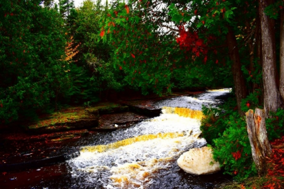
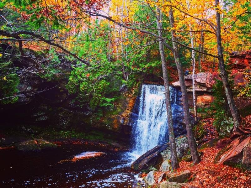
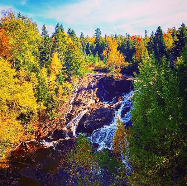
Dead River Falls
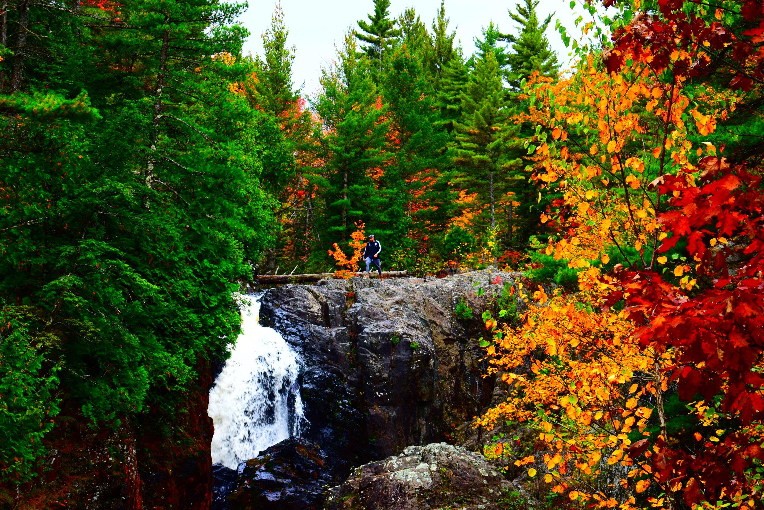
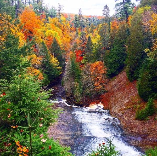
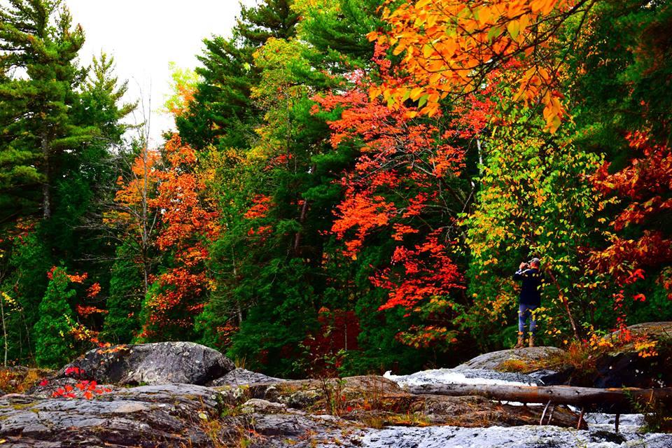
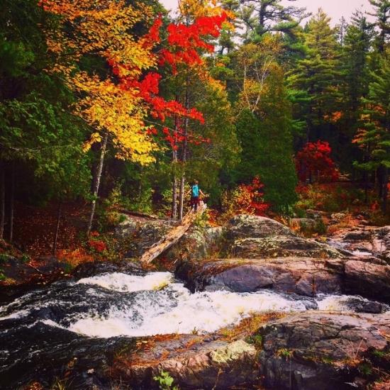
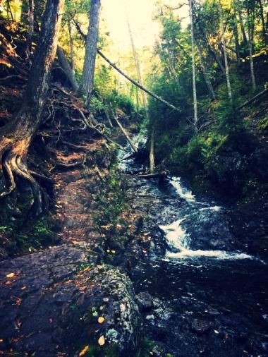
No questions asked, our favorite falls... Hands down. A local treasure embraced by Marquette natives and NMU students. Dead River Falls continues to impress as the hike goes on. As we arrived, several cars were parked, usually indicating they were worth visiting. We ascended the hill from the parking lot and came down a rugged trail. The fall colors greeted with falls roaring, leaving both of us speechless. Dead River is one of those places where people ask, "Should we keep going"? I'll be the first to give a resounding "YES" to this scenario. Michelle and I were just in awe of the terrain and the amount of falls.
The trails became extremely sketchy at points (as in not a good idea during winter or wet conditions for many), but it was worth every hesitant step. As much as Tahquamenon is promoted for U.P. Travelers, it amazes me how little Dead River Falls is brought into the conversation.
The falls are also popular among NMU cliff-jumping enthusiasts in the summertime... something I vow to return for. After 10-15 falls, separated in around a half dozen groups, we came to the backwaters of the last set of falls. An autumn-filled, pond-like pool of glass showed off every crayola color possible, and all I could think of was becoming a Marquette native. Just. WOW.
Access: Getting there by vehicle is easy. From US-41, take Wright St. north (just after the "mall"). Forestville Basin Road will be on the left, as it winds for a short distance- you will arrive at the power company property for parking. As far as the hike, the initial falls are relatively moderate. It is well worth the effort for those wanting to go through the Rugged terrain after.

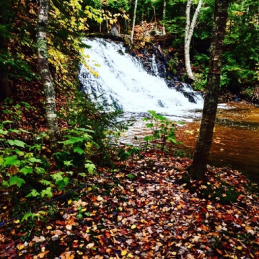
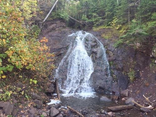
Laughing Whitefish Falls
As I continue on the "most underrated" waterfall rant, Laughing Whitefish joins Dead River Falls at the top part of the list. Before going into the whole U.P. waterfall rabbit hole, I had maybe heard of them once or twice with zero intellect on this beauty. The 20 reviews on Google Maps gave us a decent heads-up, but Laughing Whitefish blew our expectations away.
As you leave the car, there are a few Michigan State Parks signs and a functional well for North Country Trail hikers and other visitors. The trail starts out with a small waterfall, about 6-8 feet high- but don't stop there! The trail splits in two, leading to the main falls. As we walked up to the lookout at the top of the falls, our jaws about hit the floor! Peaking at around 100 feet high, we had no idea something of this stature existed in the 'Yoop.
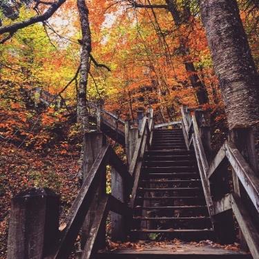
Michelle and I strolled down the 100+ stairs to get a better angle with the cameras, A must for all visitors. The water coming down the falls is only 2-6 inches deep, allowing us to get some cool pictures in the middle of the falls for perspective. As the yellow and orange leaves accompanied the pine trees, all we could do was just take it in. With this being a lightly trafficked destination, it is worth the 30-minute round trip.
Access: It is just south of M-28 at Deerton (Between Au Train and Marquette). A recreation sticker is needed because it is a State Park (Laughing Whitefish Scenic Site). From the lot, an easy trail takes onlookers to the falls, looping about 1 mile total.
Whitefish Falls
Just a few steps from the car and we were on top of one of the more remote, yet easy to reach falls in the area.- Whitefish Falls
The little brother to Laughing Whitefish, many waterfall chasers bypass Whitefish Falls despite them being relatively adjacent to LW Falls. Located in a small rustic State Campground, Whitefish is composed of two sets of smaller (but beautiful) falls. They are no more than 8 feet each, but the river runs high- making deep pools along the way. I would have been shocked to see any other people- the place looks highly underutilized.
Access: Just NW of the map dot known as Trenary on US-41, SE of Marquette. Parking is only a few hundred feet off the highway, and the walk in was around 200 yards. To its credit, Whitefish Falls is absolutely worth the 10-15 minutes of anyone's time.
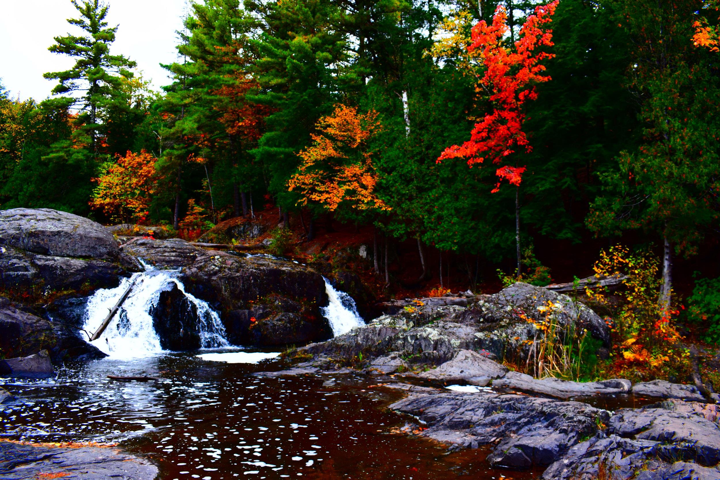
Morgan Falls
Morgan Falls on an autumn afternoon.
Though not as monstrous as Dead River or as High as Laughing Whitefish, Morgan Falls rank high in terms of solitude and serenity. Just off a popular ATV/mountain bike trail, most people blast past this set of falls. Morgan may go a day or two without anyone visiting, with the occasional fisherman, hiker or DNR officer passing by. Despite all of this, they are photogenic due to the peaceful setting- uninterrupted by human interaction.
Access: The falls are within Marquette Township, close to Marquette Mountain. Across CR 553 from the mountain is a seasonal Road (4-wheel drive is needed for most of the year) to the west. There are several spots to pull over, which requires an all-terrain stroll along The Carp River. Morgan Creek flows into the Carp River, so a short walk up the creek brings hikers to the falls.
Baraga/L'Anse Region
Powerhouse Falls is essentially a roadside waterfall, but like many of its Baraga relatives, it rarely draws a crowd because of the region's isolation from populated areas.
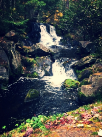
Ogemaw Falls
A quick detour led us to Ogemaw Falls. They seemed like an ideal place to set up a hammock without any other human interaction for the day. Perfect for sleeping off that famous Sweet Roll from Hilltop Restaurant down the road.
Anyone who knows the Baraga/L'Anse Region knows that Canyon Falls gets all the attention, and rightfully so. There are still several waterfalls within the area that give some amazing scenery to those willing to get out of their comfort zone. Ogemaw Falls, though not hard to get to, is a bit tricky. With the help of Google maps, trial/error, and a tiny sign, we could make quick work and enjoy these peaceful falls.
Ogemaw is another set of falls that may go days without a visitor. For one, they are not huge by any means, and they are created by a fast-flowing creek (the water volume will not attract your average paved-road-loving tourist). A short hike from the car had us to a set of falls, best described by Michelle as "Awwee! These are CUTE!" Though my reaction was not identical, I was impressed by the remoteness of Ogemaw. The other attribute we loved was how the creek ripped through the terrain, creating two sets of "lower Falls". With this being a brief stop, I highly recommend not passing by.
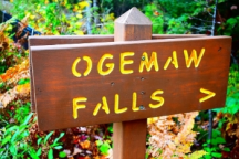
Speaking from experience, the sign leading to Ogemaw Falls is very subtle while driving... Look for a pond across the street! The hike was extremely brief, and it wasn't far off the highway.
Access: Just after Canyon Falls Park on US-41 North (towards L'Anse), in the village of Alberta, there is Baraga Plains Rd, which you will hang a left. A short drive leads to a Pond on the left side of the road and essentially a camouflage sign on the right. Park on the side of the road and hit the easy trail for 100 yards. This whole stop maybe took 20 minutes of our time, which was well spent!
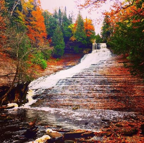
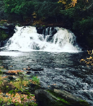
Middle Falls
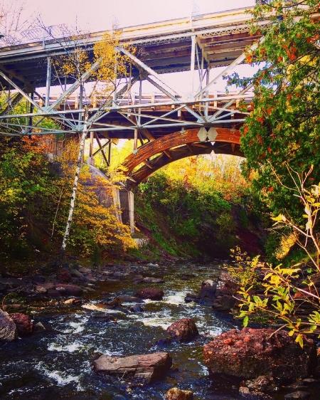
For those venturing north to the Keweenaw/Houghton area from Marquette, the town of L'Anse offers some pretty impressive falls right in town. The set of Middle Falls definitely shined as the trees turned red and gold along the Falls River.
The impressive river has a high flow creating deep pools below the waterfalls. There were several sets of falls within the quarter-mile stretch, accompanied by a small dam closer to the mouth. The old metal bridge may not serve as the best backdrop for the main falls, it does however establish some distinction from other area falls.
The clear waters proved to be utilized by local fishermen too- we saw a small group carrying a Coho salmon back to their car. This was one of those stops that travelers constantly bypass, but a 2-minute detour will provide a new appreciation for the town of L'Anse (if the beautiful shores of Superior or a Hilltop Sweet Roll have not already)!
Access: If heading north, turn right on L'Anse Ave (before the Burger King). Hang a left on Railroad street and another quick left on Sixth St. Parking was kind of informal, as we stopped at the school and walked down the hill to a two track. We walked about 100-200 yards, as this visit took around 20 minutes.
Keweenaw Region
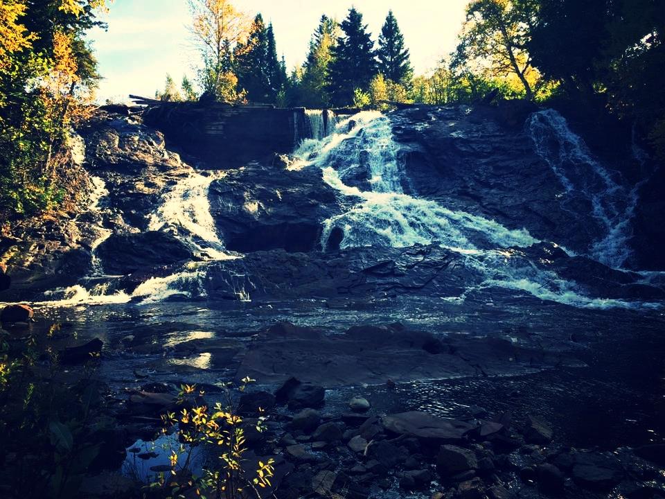
Hungarian Falls
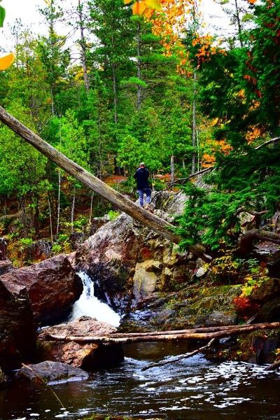
To avoid being Monotonous with the "overlooked but amazing waterfall" trend, I would say if you visit one set of falls in the Houghton area- Make these it! The best part was, as we walked up to Dover Creek with the sound of falling water, disappointment hit our faces with a fence-covered dam in sight. Figuring there was no possible way this was our destination, we headed on downstream... and it was damn well worth it.
Hungarian Falls consists of three falls, two of which are 20 feet and the lower falls are 45- 50 feet. The middle and upper were easy to view, with the hike being moderate to difficult depending on which view of the falls we were content with photographing. The lower falls proved to be more of a challenge to access from the bottom, so our view of the highest falls were restricted to the lookout from on top of the actual falls. This proved to be an amazing sight, as Torch Lake could be seen waaayyyy off into the distance over the village of Hubbell.
Upper Hungarian Falls during peak autumn... Pretty hard to beat!
We hiked during a warm October day, encountering 3 groups of hikers repping Michigan Tech gear along our journey. Some of the locals said that fall through spring is the best time, as the river becomes relatively low in the dry summer season. It is noted that views of the lower falls can be accessed via trail, but we kept moving north (Jampot Closed at 5, and some things can not be comprised).
Upper Hungarian Falls- The anticipation of visiting again in the winter Months has been building since the moment we left.
Access: Heading north into the town of Hubbell, take a left on Golf Course Rd. We parked on the roadside (there were other cars), and walked down a bumpy seasonal road for about a 1/2 mile. We both vowed to return, and I plan on hiking to the Lower Falls view next time!
We parked on Golf Course Rd. to access the falls. Most drive down this gravel road, but we decided the scenery was too pretty not to walk the half mile.
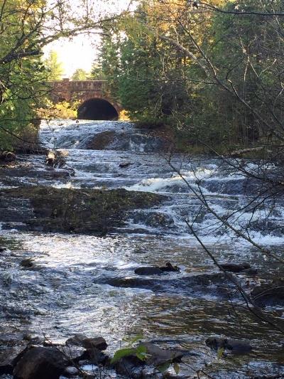
Eagle River Falls
The mighty Eagle River Falls is viewed right from the beautiful M-26 highway. To the east, there is a steep hill for a ground view (and a better sight of the Timber Bridge). Autumn at its finest!
They're huge, easy to see, and in the heart of Keweenaw Country... Perfect! With M-26 winding down, the village of Eagle River boasts some impressive falls right on the side of the road! At 60 feet high, a view from the legendary Eagle River Bridge gives onlookers epic views from above.
To get a view of the bridge with the camera, I had to climb down 30-40 feet and take a picture. This also allowed for some spectacular views of the falls from a lesser-known angle.
The historic Eagle River Timber Bridge lies just downstream from the falls. Redone in 1990, the wooden bridge now supports the sparse highway traffic for the northernmost Michigan towns.
A ground-level view of the Eagle River Falls as the sun begins to go down behind us.
Access: As you travel northeast into Eagle River on M-26, the falls and Parking are on your right... Can't miss it.
Jacob's Falls
The picture was taken right from the asphalt... with Jampot Bakery in sight. A true Keweenaw combo.
Probably more visited by Jampot customers than waterfall chasers, this roadside fall is within a football throw of the legendary bakery. Although not much in stature, Jacob's falls can be photographed from your car. Not one to settle, I had to climb up to see what others bypass. As I ventured upstream, there were more small falls that went unnoticed by most (due to growling stomachs wanting to get baked goods down the road, I'm sure).
Jacobs Falls has some hidden upper falls not seen from the road... I am definitely an off-the-beaten-path kinda guy!
Silver River Falls
Silver Creek Falls proved to be a quaint stop after Brockway Mountain for us. Hit the rough trail downstream from the parking lot for a view.
After an epic drive through Brockway Mountain, we stopped by Silver River Falls. As we pulled into the muddy lot, Silver Falls rolled underneath the bridge with no one around for miles. Another easily accessed roadside set of falls, the Silver River is about 5 minutes of time well spent. Despite them not being extremely high, they are peaceful and less traveled.
Be Aware of Private Property
Many falls on Google maps involve private property issues, or misleading access points. This can be extremely frustrating when driving in remote areas with no cell phone service. There are several websites and books for researching ways to view these wonders, and I highly recommend putting in the time before venturing out.
We struck out at many, including Houghton Falls, Black River Falls, and Rock River Falls, which were a few we attempted to access with no success (primarily lack of research).
Final Shots
“I’m going to kiss the pavement if we ever get out of here!!!! (during our failed 3 hour attempt of blind navigating the unmarked two-tracks of Mt. Avron). ” — Michelle, as we break in her brand new Volkswagen SUV
Tips For Waterfall Exploring
• Waterfall chasing works up an appetite. Some of our Western U.P. favorites were Iron Bay Restaurant and Doncker's (Marquette). Hilltop in L'Anse has good food, and a legendary sweet roll people drive from hours away for. Brickside Brewery is also worth a stop at the tip of Copper Harbor!
• If a "Waterfall run" is on the agenda, consider staying in Munising, Marquette, Baraga/L'Anse, Ontonagon or in Houghton. These areas are relatively adjacent to some close-by falls to start out your trip.
• Some of the waterfalls are right on the side of the road (Silver Creek, Jacobs, and Powerhouse, to name just a few).
• Not all waterfalls are built the same. Some may require a rough hike, others may have a crowd. Always aim for early mornings, or October Mid May to limit crowds.
• I highly recommend an atlas of the U.P. before venturing out to some of the more remote falls. Google Maps is an amazing tool, however relying on it solely with sketchy phone signals are nothing to mess with. Sometimes, even an atlas won't be helpful in these woods (I.E. Mount Avron's ever-changing logging road trip. Total disaster!!!).
• Check some falls out during winter months, as there will be minimal people out. This also allows photographers to take some shots that are not all over the "inter-webs".
• For those hiking with a fishing rod, check DNR regulations before proceeding any stream. Many streams have been closed since last Saturday in September to late April. Others have varying regulations on species sizes and creel limits.
• Keep a pair of waders/hip boots handy. While not practical for all rivers/streams, this may give an advantage for a better view of certain waterfalls
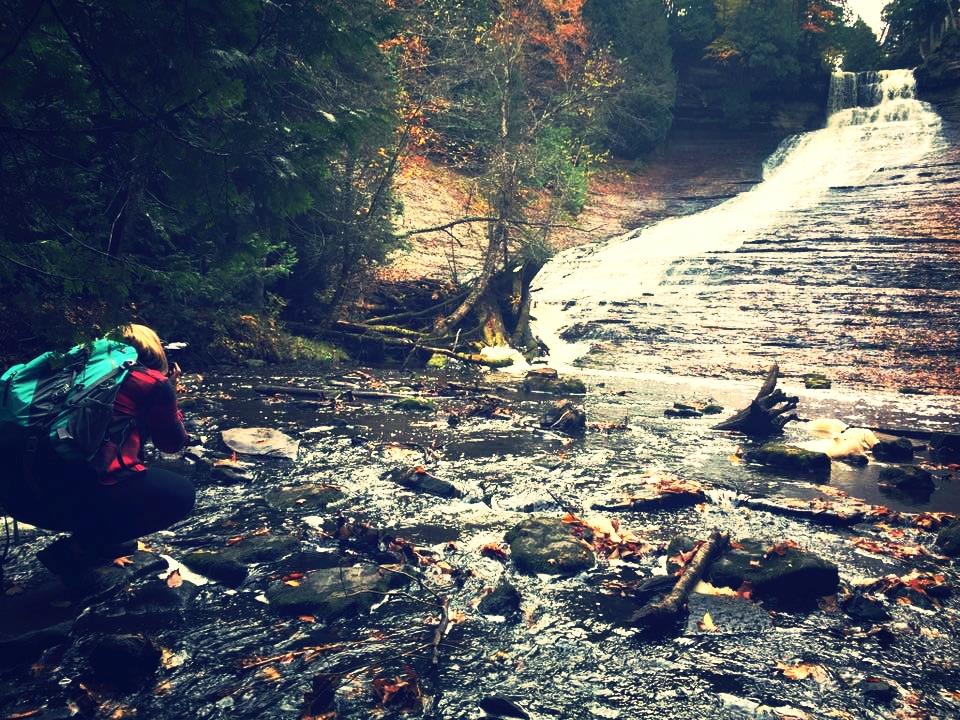
All photography was done by Michelle Guilbault and Jake Hooker.
Sometimes, for the right shot, a few fences need to be climbed. A wet foot never hurt